Israeli maps outline expanded zone of military control in Gaza
Key takeaways
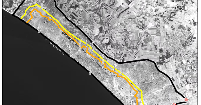
- The restricted area, marked on the maps with an orange line, makes up an estimated 11% of Gaza’s territory beyond the “Yellow Line” demarcating the part of Gaza occupied by Israeli troops since an October ceasefire.
- Israel’s military sent the maps to aid groups in Gaza in mid-March, two aid sources said, but has not released them publicly.
- The expanded zone has stirred fears from displaced Palestinians living there that they could be deemed targets by Israel, and shot.
Why this matters: local context for readers following news across Pakistan and the region.
Add ARY News on Google JERUSALEM: New maps of Gaza quietly issued by Israel a little more than a month ago have put thousands of displaced Palestinians inside an expanded restricted area, within boundaries the military says it can continue to change.
The restricted area, marked on the maps with an orange line, makes up an estimated 11% of Gaza’s territory beyond the “Yellow Line” demarcating the part of Gaza occupied by Israeli troops since an October ceasefire. The areas cordon off nearly two-thirds of Gaza’s territory in total.
Israel’s military sent the maps to aid groups in Gaza in mid-March, two aid sources said, but has not released them publicly.