NASA’s PACE Mission Studies Smoke, Fires
Why this matters: new research or scientific developments with potential real-world impact.
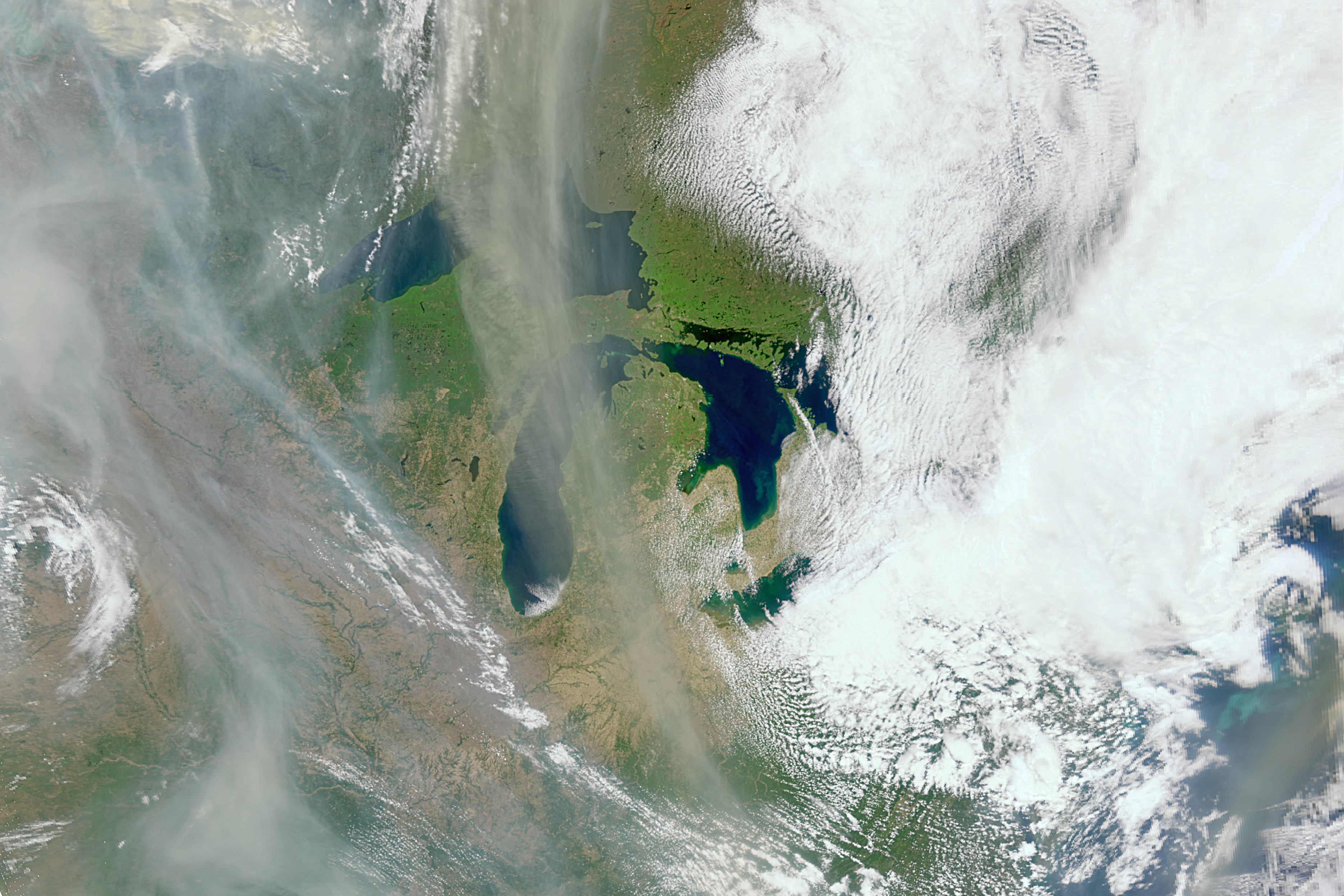
This data will help scientists piece together clues that deepen their understanding of wildfires. “The challenge that we have is to take those clues and use them in a meaningful way, so our models of Earth properly represent what’s happening,” said Kirk Knobelspiesse, a remote sensing scientist working on the PACE mission at NASA’s Goddard Space Flight Center in Greenbelt, Maryland. Wisps of smoke coming from fires in multiple provinces and territories in Canada travel over the Great Lakes. This image was taken by the Ocean Color Instrument aboard NASA’s PACE satellite on May 31, 2025. NASA While the satellite, which launched in February 2024, was designed to study Earth’s ocean and atmosphere, it has an unexpected capability: monitoring changes to vegetation. It can also tell us about burn scars, the charred area of land left behind after a wildfire. “The PACE satellite observes land too, and does it really well,” said Skye Caplan, terrestrial lead for the PACE mission at NASA Goddard. “There is so much to explore with a new hyperspectral data set.” The Ocean Color Instrument on board PACE is a hyperspectral instrument, observing the planet in several hundred different wavelengths of visible, near infrared, and ultraviolet light. This breadth of the spectrum allows it to gather data on the health of plants, such as their state of stress, dryness, and their relative pigment balance, all of which assist in identifying high fire-risk areas. Land managers can use this data to distribute resources to help mitigate fire risk. This instrument views the entire Earth daily, with more frequent coverage at high latitudes. With this frequency, on