Cyclone Rains Spur Papua New Guinea Landslides
Why this matters: new research or scientific developments with potential real-world impact.
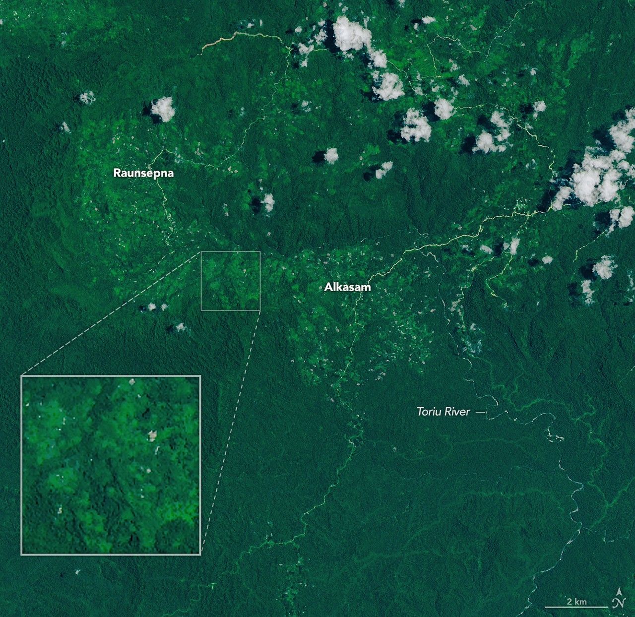
Earth Observatory Science Earth Observatory Cyclone Rains Spur Papua New… Earth Earth Observatory Image of the Day EO Explorer Topics All Topics Atmosphere Land Heat & Radiation Life on Earth Human Dimensions Natural Events Oceans Remote Sensing Technology Snow & Ice Water More Content Collections Global Maps World of Change Articles Notes from the Field Blog Earth Matters Blog Blue Marble: Next Generation EO Kids Mission: Biomes About About Us Subscribe 🛜 RSS Contact Us Search Sept. 24, 2025 April 20, 2026 NASA Earth Observatory/Michala Garrison NASA Earth Observatory/Michala Garrison Sept. 24, 2025April 20, 2026 NASA Earth Observatory/Michala Garrison NASA Earth Observatory/Michala Garrison Sept. 24, 2025 April 20, 2026 CurtainToggle2-Up Image Details During a break in the clouds, the OLI (Operational Land Imager) on Landsat 9 captured an image of landslide fallout in the forested Gazelle district of East New Britain on April 20, 2026 (right). A second image from Landsat 9 shows the same area on September 24, 2025 (left), before the landslides. Since much of Papua New Guinea lies close to the equator where the Coriolis effect is weak, the risk of tropical cyclones striking the island nation is relatively low, especially in its northern areas. Nevertheless, unusually warm sea surface temperatures and atmospheric conditions favorable to storm formation brought powerful Tropical Cyclone Maila dangerously close to the islands of Bougainville, New Britain, and New Ireland in April 2026, fueling intense rainfall. The heavy rains saturated steep terrain in the Gazelle district of East New Britain, triggering landslides on and around April 9 that led to several deaths, according to news reports. The Landsat 9 satellite captured an image of the fresh landslide scars cutting through the dense tropical forests in the Baining Mountains on April 20, 2026. The Toriu River and other sediment-laden waterways are visible to the east of the landslides. The landslides app