US-Indian Space Mission Maps Extreme Subsidence in Mexico City
Why this matters: new research or scientific developments with potential real-world impact.
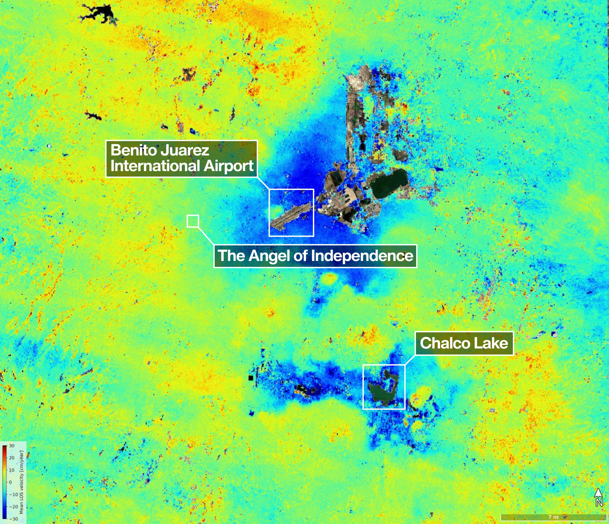
New data from NISAR shows where Mexico City and its environs subsided by up to a few centimeters per month (shown in blue) between Oct. 25, 2025, and Jan. 17, 2026. Uneven and seemingly small elevation changes have added up over the decades, fracturing roads, buildings, and water lines.NASA/JPL-Caltech/David Bekaert One of the most powerful radar systems ever launched into space has mapped the ground moving beneath one of fastest subsiding capitals in the world: Mexico City. The findings show how quickly and reliably the NISAR (NASA-ISRO Synthetic Aperture Radar) satellite can track real-time changes across Earth’s surface from orbit, unhindered by clouds or vegetation that impede optical sensors and higher-frequency radars. Home to some 20 million people, the Mexico City area is built atop an aquifer. Extensive groundwater pumping, combined with the weight of urban development, has resulted in the compaction of the ancient lakebed beneath the city for more than a century. An engineer first documented the issue in 1925, and by the 1990s and 2000s, parts of the metropolitan area were sinking by around 14 inches (35 centimeters) per year, damaging infrastructure including the Metro, one of the largest rapid transit systems in the Americas. Several generations of space-based radar have tracked Mexico City on the move. The NISAR mission, launched in July 2025, is now advancing these efforts, analyzing fast-changing areas that are challenging to survey from space. Capable of working day and night, rain or shine, NISAR’s L-band synthetic aperture radar is designed to track subtle motions such as land sinking and rising, glaciers sliding, and croplands growing, as it passes overhead multiple times a month. “Images like this confirm that NISAR’s measurements align with expectations,” said Craig Ferguson, deputy project manager at NASA Headquarters in Washington. “NISAR’s long wavelength L-band radar will make it possible to detect and track land subsidence in more challengi