El Nino arrives in Pacific with high odds of historic winter strength
Key takeaways
- This year’s event could rival the strongest occurrences since modern record-keeping began in 1950.
- “We’re seeing a pretty clear atmospheric response in the pattern of pressure, winds, and rainfall over the tropical Pacific Ocean,” said Michelle L’Heureux, a meteorologist with NOAA’s forecast team.
- El Niño events occur when ocean waters along the South American equator become unusually warm, fundamentally altering global weather patterns.
Why this matters: local context for readers following news across Pakistan and the region.
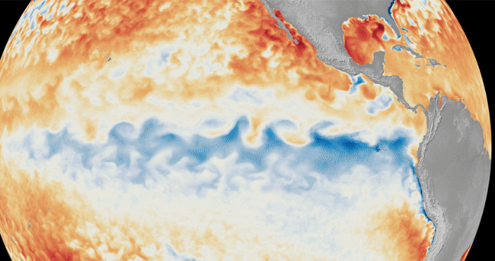
Add ARY News on Google AAResize Scientists at the National Oceanic and Atmospheric Administration (NOAA) announced on Thursday a 63 percent chance that very strong El Nino conditions will form between November and January. This year’s event could rival the strongest occurrences since modern record-keeping began in 1950.
“We’re seeing a pretty clear atmospheric response in the pattern of pressure, winds, and rainfall over the tropical Pacific Ocean,” said Michelle L’Heureux, a meteorologist with NOAA’s forecast team. “Communities should see this as an option to assess risk and prepare.”
El Niño events occur when ocean waters along the South American equator become unusually warm, fundamentally altering global weather patterns. Currently, water temperatures in the region are around 1.3 degrees Fahrenheit above normal. NOAA indicates a high probability that these temperatures will spike to 3.6 degrees Fahrenheit above normal by winter.