Tracy Arm’s Post-Tsunami Landscape
Why this matters: new research or scientific developments with potential real-world impact.
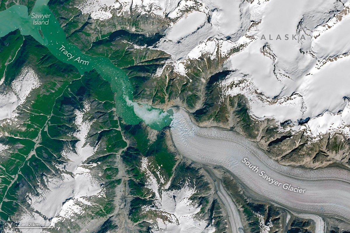
Earth Observatory Science Earth Observatory Tracy Arm’s Post-Tsunami… Earth Earth Observatory Image of the Day EO Explorer Topics All Topics Atmosphere Land Heat & Radiation Life on Earth Human Dimensions Natural Events Oceans Remote Sensing Technology Snow & Ice Water More Content Collections Global Maps World of Change Articles Notes from the Field Blog Earth Matters Blog Blue Marble: Next Generation EO Kids Mission: Biomes About About Us Subscribe 🛜 RSS Contact Us Search July 26, 2025 August 19, 2025 NASA Earth Observatory/Michala Garrison NASA Earth Observatory/Michala Garrison July 26, 2025August 19, 2025 NASA Earth Observatory/Michala Garrison NASA Earth Observatory/Michala Garrison July 26, 2025 August 19, 2025 CurtainToggle2-Up Image Details The shores of Tracy Arm, a fjord in southeast Alaska, are stripped of vegetation following a landslide and tsunami that occurred on August 10, 2025. The OLI (Operational Land Imager) on Landsat 8 and Landsat 9 show the area in the weeks before and after the event, respectively. Carved over millennia by the pressure and motion of glacial ice, the valley walls cradling the Tracy Arm fjord in southeast Alaska continue to be reshaped. In summer 2025, following the rapid retreat of South Sawyer Glacier, a large landslide sent rock careening into the fjord, altering the wider landscape in a matter of minutes. The slide culminated on the morning of August 10, 2025, when at least 64 million cubic meters of rock slid downslope. Material entering the fjord induced a tsunami that stripped trees and other vegetation from the opposing fjord wall up to 1,578 feet (481 meters) above sea level. While this peak was the highest “runup” reached by the tsunami, shores and islands down the fjord also saw substantial destruction. NASA-USGS Landsat satellites captured these images on July 26 (left) and August 19 (right), before and after the event, respectively. “The bright landslide scar on the north side of the fjord is striking,