Fire’s Footprint on Santa Rosa Island
Why this matters: new research or scientific developments with potential real-world impact.
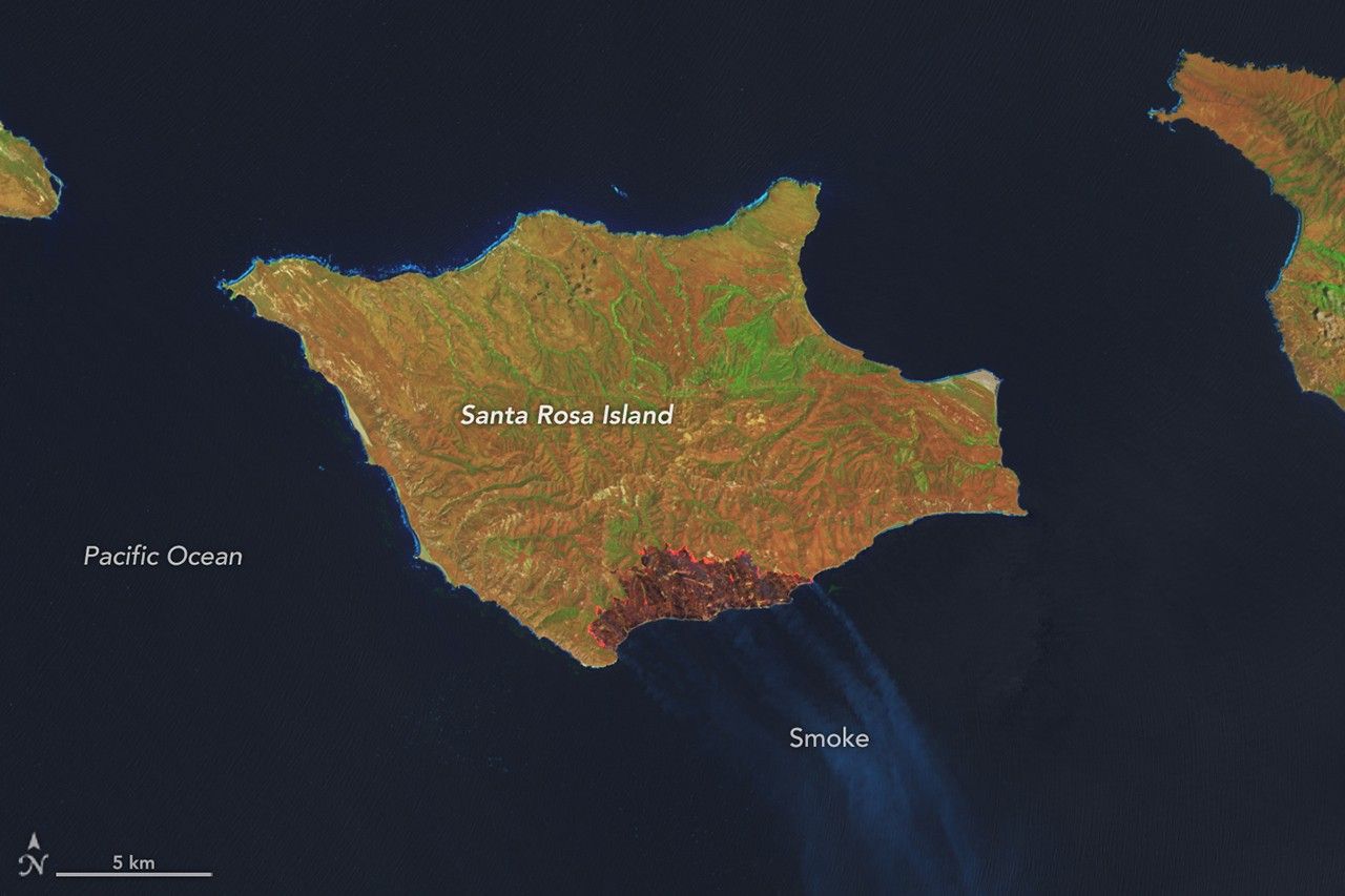
Earth Observatory Science Earth Observatory Fire’s Footprint on Santa… Earth Earth Observatory Image of the Day EO Explorer Topics All Topics Atmosphere Land Heat & Radiation Life on Earth Human Dimensions Natural Events Oceans Remote Sensing Technology Snow & Ice Water More Content Collections Global Maps World of Change Articles Notes from the Field Blog Earth Matters Blog Blue Marble: Next Generation EO Kids Mission: Biomes About About Us Subscribe 🛜 RSS Contact Us Search May 16, 2026 May 24, 2026 A false-color image of Santa Rosa Island from May 16, 2026, shows a dark-brown burned area toward the bottom-right. A thin, bright orange line runs along the burned area, indicating the active fire front. NASA Earth Observatory / Lauren Dauphin A false-color image of Santa Rosa Island from May 24, 2026, shows a reddish-brown burned area spanning the eastern third of the island. NASA Earth Observatory / Lauren Dauphin May 16, 2026May 24, 2026 A false-color image of Santa Rosa Island from May 16, 2026, shows a dark-brown burned area toward the bottom-right. A thin, bright orange line runs along the burned area, indicating the active fire front. NASA Earth Observatory / Lauren Dauphin A false-color image of Santa Rosa Island from May 24, 2026, shows a reddish-brown burned area spanning the eastern third of the island. NASA Earth Observatory / Lauren Dauphin May 16, 2026 May 24, 2026 CurtainToggle2-Up Image Details The burned area from a wildland fire on Santa Rosa Island in California’s Channel Islands National Park grows between May 16 (left) and May 24, 2026 (right), in these false-color images captured by the OLI (Operational Land Imager) on Landsat 9 and Landsat 8, respectively. On May 15, 2026, a fire was spotted from aircraft on the southeastern side of Santa Rosa Island, part of California’s Channel Islands National Park. The blaze spread over the next several days, ultimately burning 18,379 acres (7,438 hectares)—about one-third of the island. These imag